This is the same Mapbox engine that renders inside Sequorr. Switch styles, then flip to 3D to pitch the camera and watch the terrain rise — exactly the toggle you get on an activity screen in the app.
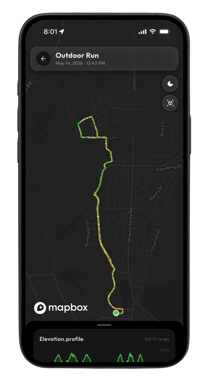
Dark is what you see first. The basemap recedes into near-black so the only thing competing for your attention is the route — and the effort grading painted along it, green through red. At 6 a.m. or mid-run on a bright screen, a dark canvas is easier on the eyes and makes the line pop.
It's the right default for a training tool: you're reading your data, not sightseeing. Streets and labels stay legible but quiet.
Mapbox styledark-v11
Best forDaily logging
ReadsRoute & effort
The reality check · Satellite
See exactly where you actually were.
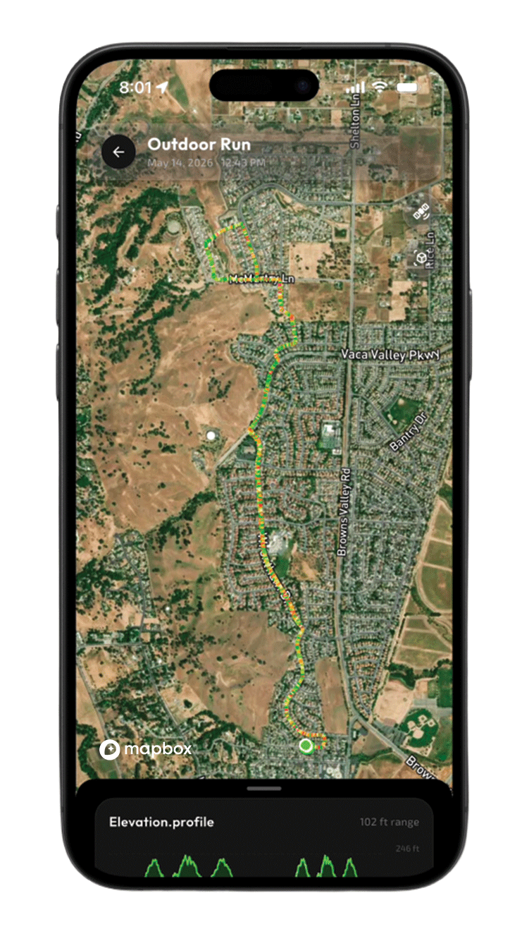
Satellite swaps the abstraction for real aerial imagery. Suddenly the route isn't lines on a grid — it's the actual neighborhood, the open hills on the west side, the field you cut across. It's the style for recognizing a route at a glance and for understanding the surroundings of a run you don't know yet.
Maxar imagery under Mapbox's satellite-streets style keeps road and place labels on top, so you get context without losing your bearings.
Mapbox stylesatellite-streets-v12
Best forRecognizing terrain
ReadsReal surroundings
The terrain map · Topographical
Read the hills before you run them.
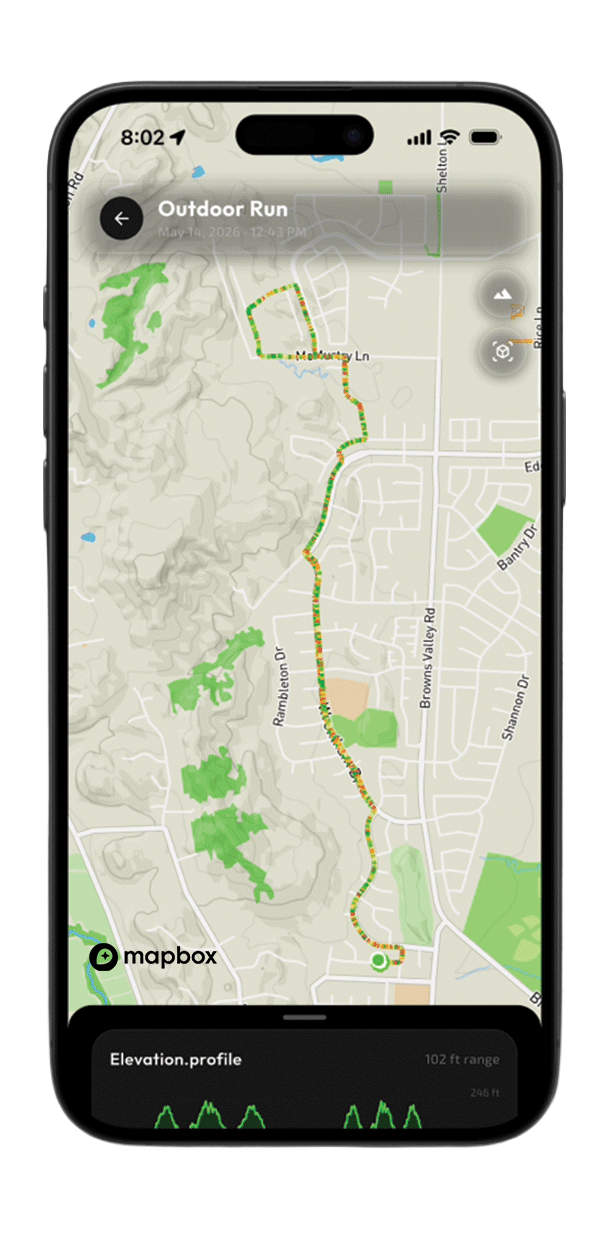
Topographical leans into elevation. Contour shading, trails, parks, and green space all come forward — the view that matters when the climb is the workout. For trail runners and anyone chasing vert, this is the style that explains the elevation profile sitting at the bottom of the screen.
One honest tradeoff: a busier basemap means the route line works a little harder to stand out. That's the deliberate cost of terrain context, and exactly why Sequorr lets you switch rather than picking one map for everyone.
Mapbox styleoutdoors-v12
Best forTrails & elevation
ReadsContours & vert
Why three, and why a toggle?
No single map is right for every run. The same loop reads completely differently as a dark training canvas, a satellite reality check, and a topographical terrain map. Rather than choose for you, Sequorr keeps all three a tap apart — and adds an element to toggle on 2D or 3D routes, visually enhancing your angle of perspective.
The 3D view isn't a separate map — it's the same style, elevated. Sequorr offers the map to offer accessible preview of terrain elevation data and view angles. Dark, Satellite, and Topographical each gain real depth. Hills you only inferred from the elevation profile become something you can see at a glance. Try the toggle in the live map above.
Same engine · Sequorr Findrr
The race map runs on the same tiles.
Sequorr Findrr — our race discovery map — isn't a separate mapping system bolted on the side. It renders on the same Mapbox tile pipeline that draws your activity routes. The pins for thousands of races across the country sit on the exact basemaps you've been switching between above: the dark default, satellite, and topographical.
That's deliberate. One tile pipeline means a single, consistent map language across the whole product — the map you learn while reviewing a run is the same map you use to find your next race. It also means the styling work, the 3D terrain, and the performance tuning all carry straight over from activity maps to Findrr with nothing to relearn.
Findrr currently maps thousands of races sourced through our event pipeline, and because it shares the same Mapbox foundation, every improvement to the map experience lands in both places at once.